Your Cart is Empty

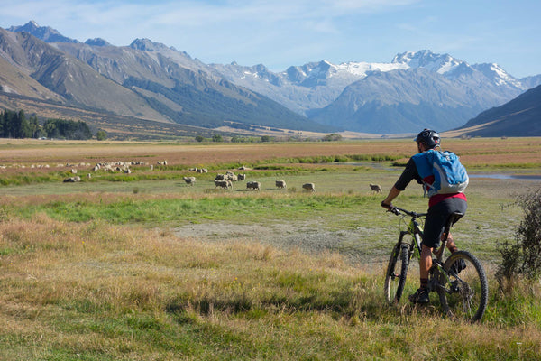
At some point in a life time as the years tick slowly by, you say “Last Ride” and sometimes you truly mean it. It may be during a favorite epic, or just before you turn that first pedal stroke, or a random thought whilst pawing over a well worn map. You may be confronted with a forgotten massive gnarly hill climb after a long day with no end in sight. Well we may have found our “last ride moment” twice in the Ahuriri Conservation Park.
Back in 2012 we rode in from Avon Burn to Tin Hut, we went up to Mt Martha Saddle and dropped down to the Top Timaru Hut. From there we climbed below Mt Prospect and along the undulating Melina ridge-top before dropping back down to Tin Hut then back out the Avon Burn. This rugged 4WD loop was in reasonable order, with just a few slips, the odd carry section, but mostly rideable in this anti-clockwise direction.

Fast forward to Feb 2016 and we enthusiastically decided to repeat this epic in a clockwise direction, for reasons at the time that seemed quite plausible and clear. Something along the lines of, more gradual uphills and much better downhills. Rose tinted memories, their accuracy had long evaporated in the mist of time. The ride started out as it had done so four years previous, with valley mist and the promise of a sunny and windless day. The ride to Tin Hut follows the Te Araroa Trail route, the walk itself has taken on a life of its own and a status that should be reserved for interstellar flight and time travel.
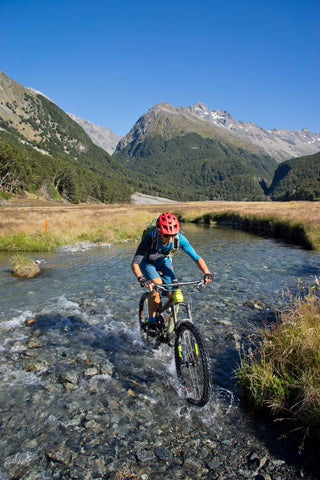
From the hut the track climbs brutishly to a low saddle overlooking the Lindis River and more dozer track per hectare than dairy cows in Canterbury. Unlike dairy cows in Canterbury these tracks are a mecca for mountain bikers that want to build moral fibre and suffer at the hand of gravity. From the saddle the Melina ridge track climbs steeply westward with all manner of rocky objects strewn across a once pristine dozer track. It follows a fence line onto the tops and delivers stunning views everywhere. The ride along the tops is the same, new mountains revealed, valleys and gorges appear around every corner and on every climb. It must be without a doubt the most ruggedly scenic ride in NZ. But it's hard work. It's undulating terrain at over 1600 meters is no place to be caught napping when the weather goes pear shaped. There's no shelter and no quick exit to the valley floor below.

We noticed quite early on that the track had deteriorated in places and become remarkably vague in others. Some of the scree and rock slides were swallowing chunks of the track with only animal tracks visable across the rocky soup. We headed up to Mt Prospect on the final climb south, with downhill and beech forest to the Top Timaru Hut awaiting us. To our surprise the track had slid into rack and ruin, making it a great downhill, but in an anti-clockwise direction, a daunting uphill. It's a mesmerizing descent. We were captivated by the sheer beauty of the perfect blend of snow-grass, spaniard and beech forest covering such steep terrain while dodging slips, rocks and flora. Relax and concentrate became a mantra.

We found the four bunk Top Timaru Hut brimming with Te Araroa (TA) pilgrims from the four corners of the globe and it was only 2:00pm. The reverence these young ones showed NZ was inspiring, as we often take our backyard for granted. All the things the world has to offer condensed into two easily accessible islands in the middle of nowhere. We refueled and rehydrated for the massive climb up to Mt Martha saddle.

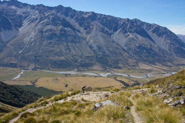
The valley was hot and windless and to make matters worse, what we had cruised down four years earlier, had become slips and more slips interspersed with bouts of technical riding. The start of the climb rises up out of the valley, dances around a couple of switch backs and does an endless traverse across a semi stable scree slope, before finally zig zagging its way up to the saddle. Needless to say riding was only possible at the limit of moral fibre, dodging rocks and gaining traction at the wrong end of what was becoming a particularly hard day. Riding and pushing were an even split with a nice bit of respite on the long final traverse up to Mt Martha Saddle at a lofty 1770 meters. We rested and soaked up the view, cooling down in a light breeze that the mountain thermals afforded us and thought “last Ride”.

After all the pain and suffering of the climb, the downhill back to Tin Hut proved to be an awesome payback. The top section was infinitely rocky but with no slips to derail our downward train and the lower slopes were great fun all the way to the hut. We lingered on the terrace above the hut soaking up the late afternoon sun before heading back out the way we had come. Along the way we encountered two groups of TA walkers. One, a Swiss guy who had been a professional cyclist racing with Fabian Cancellara and now doing 50kms per day on the TA, plus a couple of cyclists biking in to camp nowhere in particular. The end for us came soon enough. This may well be the very last ride on this particular circuit, never say never.

Camping in the Ahuriri Conservation Park is almost a religious experience. It's hard to put into words; the mountains, the river, the light and the way the shadows move across the valley and the stars come out at night. The ride up the valley to Top Hut and the ride/walk into Canyon Creek and up to the waterfall face of the Huxley Range, has become a regular pilgrimage for us. If time permits we indulge our inner S & M with a ride to Base Hut and then grovel up an old dozer track onto the Dingle Burn Tops. This offers stunning views and all the more reason to consider the Ahuriri Valley sacred ground.

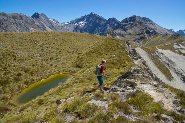
The day started out swimmingly, the ride to the bottom of the hill was all goodness and light. The track heads into a healthy looking beech forest. The lower section has always been a bit washed out, but single track through the bush bypasses all the wind fall and ruts. We broke out into the open and for awhile the track stuck to past experience, but alas the rest of the stream dwelling part of the climb had become boggy and un-ridable. Above the slush, the zig zags up the ridge face (that were always a bit on the rivet), had degraded to a barely ridable state and become somewhat overgrown. On the ascent we moved a few hidden rocks, as downhill due diligence dictates a 'no surprises policy' and the edge of the track plummets in awkward places. The relief from the cooling breeze on the ridge top revived flagging spirits and drove us northward along the ridge. A massive jumble of up standing rocks resides there and beyond, a hidden tarn above a massive slip. This afforded us lunch with views the full length and breadth of the Ahuriri Valley and down into its parallel twin, the Dingle Burn Valley. This valley wanders out to Lake Hawea, but with little single track on offer we were not tempted to descend.
The return downhill proved sketchy and on edge for us mere mortals, but so much fun to ride that we almost forgot about the grovel up. Therefore we wrote it down (just in case our memories lapse). Time gentleman time, last ride, no more orders. Maybe we just need to do some Eastern Block riding and harden up?