Your Cart is Empty

Be prepared for winter and you’ll be prepared to seek out fun when it's cold or wet. The St James Range was first on my and Anja's list for ten days of adventuring. Some urbanising in Christchurch and time on the Paparoa Track rounded out our southern winter excursion.


Departing the vehicle and pedalling the 10km of road.
Heading over the rain-damaged Jollies Pass Road from Hanmer, I breathe in the stunning scenery, the open golden brown landscape and the snow-capped peaks. The St James Range is a relatively new discovery for me - singletrack that reminds me of the French Alps and Provence, beautiful character-filled huts capturing times past and age-old systems that are still in use today. Most of these huts are supported with well-used horse infrastructure, grazing pens, shelter and water. It all feels like a time warp... the huts with their open fires, smoke-stained books lining the shelves above and beautiful mud-brick walls between the timber framing.

Fowlers Hut and the start of the singletrack climb away from the road.

Fowlers Pass climb and the Rainbow Road in the background.
But I’m getting ahead of myself. Before one gets to absorb all this awesomeness there is a bit of work to be done. Our day started with a leisurely morning soak in the Maruia hot springs. Consequently the day was marching on when we parked Lance the Landcruiser on the Rainbow Road near the gate to the Peters Valley Track - the exit point at the end of our Fowlers Pass - Stanley loop.
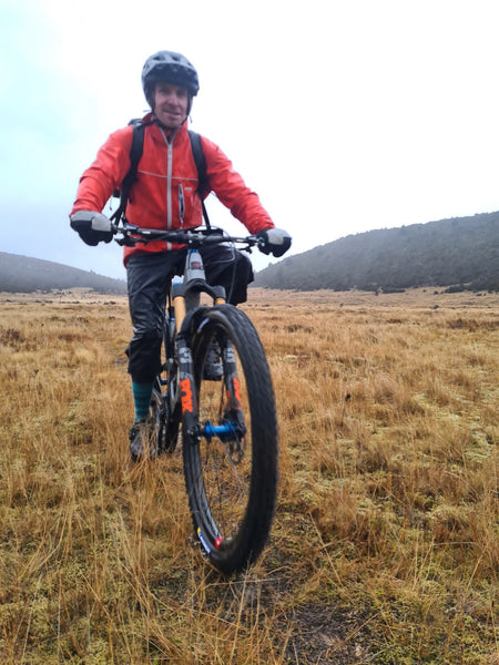
I loaded everything in my 35-litre backpack while Anja opted for bikepacking bags. We warmed up on the 10 km of gravel to Fowlers Hut and the start of the singletrack up to Fowlers Pass. There was a cold breeze blowing and it was a slow climb with Anja suffering an asthma attack - her first in over four years.
It became obvious we were not going to make the historic Stanley Vale Hut in daylight, and most likely not even the Pass. Neither of us were phased as we were well prepared. Reaching the Pass in the pitch dark, so it was on with our night lights. The amazing descent down the perfect tight switchbacks was a blast.

Fowlers Pass climb - it’s a beauty.
There was a bunch of small creek crossings as we made our way down the upper reaches of the Stanley River. Eventually the trail opens onto a huge triangular grass plain, with the Stanley on one side pointing out to Lake Guyon. With some very vague trail marking and not any notable signage we managed to navigate the open plain to find the Stanley Vale Hut.
What a beauty this hut is. The smell, the horse equipment, the rustic mud and straw walls infilling the exposed timber frame. The Virgin Mary hangs above smoke-stained books with an open fire to the right. To the left is a half wall separating the bedroom with its classic DOC bunk beds.
The fire was soon roaring and dinner was on. Lying in bed and looking through the open door frame to the open fire was just another magic moment from the trip and a magic end to the day.


Blessed be this hut - Stanley Vale, one of my all-time favourites.

My only picture of the outside of the Stanley Vale Hut - from a previous trip.
After a wild night with the wind whistling at the hut edges and rain drumming on the roof, the morning dawned with the promise of better weather. But after breakfast, I stood at the door dressed in full wet weather gear and watched tall column-like sheets of rain driving across the plains.
Setting out from our shelter into a day of wet, cold and unknown adds a spicy wee edge to the departure. Before the plains narrow back into the river valley, we navigated some boggy sections of trail where one needs to take care not to throw yourself over the bars… I’ve seen it done here before.
Most of the Stanley is a wide trail on disused farm track, now more and more of it 'growing' into singletrack. It's a pleasurable ride on these old tracks and there is really only one section over some bluffs and gorge that people have to push.
The rain was steady. Not overly heavy but I was beginning to feel distracted by the upcoming river crossings. We had five to tackle before the water levels rose beyond our capacity. We completed the first three without much issue, but with every kilometre there were more and more side creeks joining the party. By mid morning the rain had set in pretty steady.

Anja on the first low-flow river crossing managing unassisted.
As we descended a sweet piece of trail down to the fourth crossing I became more concerned. It was a much narrower part of the river, and it soon turned sharply into the afore mentioned gorge. There were no braids to dilute the flow, and the runout, if one of us swam, was okay but not ideal.
Understanding rivers is very important to making sound decisions. Surface waves and ripples tell you a lot about the terrain underneath, helping determine the safest crossing point and angle of attack. Anticipating a potential swim and planning your downstream exit is important preparation.
It wasn’t the day to even consider entry and exit at the low water flow crossing points. I walked to the edge, waded out to test the waters while holding my bike on the downstream side, one hand on a handlebar grip and the other at the rear of the frame top tube. The bike pulls away but that is good, you don't want it upstream pushing into you. The drag of the two wheels facing the direction of your travel acts like a walking stick to balance your difficult steps on the round boulders below.
Satisfied with my test of the depth and current, I retreated and briefed Anja. I committed to the crossing at a long downriver angle without any drama but I had to return on another new and unknown downriver angle, albeit without my bike or backpack. Anja is shorter and lighter than me so I carried her bike across and then came back again. We linked together - waist belts undone, with one arm between the back and backpack and either holding onto the far shoulder strap down low by the waist or securely holding a fist full of clothing. This creates a strong, flexible but braced connection. Again like the bike, having two people softens the uncontrolled movements enroute and helps to stay upright.
The rain was stronger now and the final crossing was still to come. I knew we would just have to wait and see but I was aware that I was calculating what-ifs, including make-shift shelters and how many hours we could survive in the nasty conditions before getting too cold.
The last crossing was again in narrow river bed. Scouting about I found a more promising spot roughly 500m upriver from the natural trail crossing. A similar story to the last crossing unfolded except there was a little more rejoicing and lightening of focused energy. I was quite relieved to have it all behind us without any overly wild moments or unexpected swims.
Don't be fooled by what looks like an easy crossing, it doesn't take much to make a river impassable.
This is where a 200m climb leads up to a section called the Racecourse. A cold and wet lunch was had, huddled in the matagouri scrub beside a small creek. We got a bit cold here and soon after were on the exposed flats of the Racecourse, but as we tipped across the low saddle at the end we were having fun riding some great traversing singletrack. The manuka was bending and flapping around us as the wind and rain swept through, but we were having fun and knew Scotties Hut wasn't too far away.
Pictures with a wet camera on the Racecourse.
A new wide swingbridge carried us safely over the Edwards River which is right beside Scotties Hut - a four-bunker that does not feature high on the romance scale but was a very welcome sight in these conditions. There is no fire but it does for some reason have solar lights, and that's about all.

Crossing the Edwards, with Scotties Hut in the background
Another night with the wind and rain reminded us of the wild day we’d just had. Morning broke with a clear sky, a cold breeze and the roar of the Edwards in flood.

The Edwards River flooding the road.
It was only about 12 or so kilometres out to the Rainbow Road. We would pass some hot springs but figured they would be well under the flooded waters of the side valley they sit in. There is beautiful stone work around the spring creating about three pools to be enjoyed. Well, that wasn't on the cards for us today, we had other waters to deal with.
Looking at the river from the door of Scotties Hut I was thinking, "Low chance that will we get across”. But I'm always amazed how a wider section of river bed can reduce flow and depth, making an impossible ford magically possible. Our luck was in and we found a manageable location to cross with careful ease.

After about 8 km of criss-crossing up the Edwards Valley, we climbed onto the plateau near Peters Pass and joined the Peters Valley loop track.

The 4WD track out from here is slanted pleasantly downwards making the last few kilometres relatively easy going. And then there was Lance the Landcruiser still parked where we left him ready to whisk us out into suburban Hanmer Springs. With a little shock we viewed this busy world through a lens of nature, and the power of that experience was still alive in us both.
This is a great trip, though if you're inspired I’d definitely recommend choosing a weather window outside of a cyclone. But, prior knowledge of the track helped us and the wet could never dampen the super scenery.

